LiDAR and 2013 Orthos Available
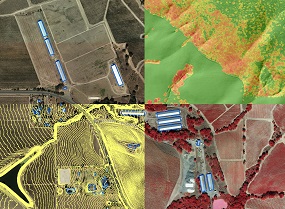
Land managers, planners, engineers, and geogeeks will be glad to hear that - for the first time ever - Sonoma County has complete countywide LiDAR data! These
data, which include the point cloud, numerous raster deliverables, and
simultaneously collected 4-band, 6-inch orthophotography are the first deliverables of the Sonoma County Vegetation Mapping and LiDAR Program (Sonoma Veg Map).
The data are free and publicly available. For instructions on how to access the data, click here.
For a quick demo, check out this video.
For the list of data products that are available now, click here. For more background on LiDAR check
out this blog post or this basic one page LiDAR primer. Also check out the presentations from our
LiDAR and Environmental Data Forum held last spring.
Funding partners that contributed to this data collection include the Sonoma County Agricultural Preservation and Open Space District, the Sonoma County Water Agency, the California Department of Fish and Wildlife,
the United State Geological Survey, the Sonoma County Information Systems Department, the Sonoma County Transportation and Public Works Department,
The Nature Conservancy, the City of Petaluma, NASA, and the University of Maryland.
For more information see the program web site.
back to top
LiDAR Rollout at the Water Agency
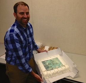
On May 2nd, the Sonoma County Vegetation Mapping and LiDAR Program celebrated the delivery of a suite of LiDAR and orthophotography data products at the Sonoma County Water Agency.
The meeting was a coming together of consortium members and other natural resource agencies to recognize the role collaboration played in obtaining these data. The discussion focused on the need
to continue to raise awareness of the value of these data and on ways to access and use these data. After the presentation, a LiDAR imprinted cake was served!
The May 2nd meeting occurred almost exactly one year after and in the same room as our LiDAR
and Environmental Data Forum. That forum featured LiDAR experts and raised the collective local knowledge of LiDAR
technology and its many uses in land and natural resource management and planning. Now, one year later, we celebrate
the first countywide LiDAR dataset!
back to top
U. of Maryland Carbon Field Work Begins
As a companion study to the vegetation mapping program, Dr. Ralph Dubayah from the University of Maryland is producing a map of carbon sequestered in Sonoma County's live vegetation.
This work is funded by NASA (read more in this press release).
When natural vegetation (biomass) is removed, much of the stored carbon is released into the atmosphere as carbon dioxide, a greenhouse gas.
The carbon data will be embedded into the fine-scale vegetation map in order to quantify the role natural landscapes play in reducing climate change.
The carbon map will be created using information derived from the new LiDAR data and orthophotography. Carbon mapping also requires field
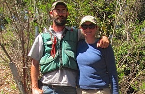
data with detailed information about tree size, density, and height. Dr. Dubayah and his group at the University of Maryland have hired a local botanist, Aaron Arthur
from WRA, Inc., to collect the field data. Working with the University of Maryland's Amanda Whitehurst, Aaron began his variable radius plot data collection
in April. In just over one week, Aaron and Amanda (photo above) made major headway, collecting 39 plots across northern Sonoma County.
back to top
Lifeform Mapping Underway
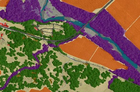
The mapping team is busy incorporating the new LiDAR data and orthophotography into the vegetation mapping pipeline. The lifeform map - a map of cover type - is the next major
product of the program and will be complete in roughly one year from now.
The lifeform map serves as the foundation for the much more detailed
fine-scale vegetation map. At this time, the mapping team is working to finalize the details of the lifeform map's specifications and working to complete the
"expert systems" ruleset that will be used to create the lifeform map. Expert systems rulesets use software to automate the decision making processes of
human photo intepreters, reducing the amount of work needed for the most laborious and time consuming parts of vegetation mapping.
back to top
|