
As part of its Streamside Maintenance Program (SMP), The Sonoma County Water Agency has been using the 2013 Countywide LiDAR data to help manage vegetation within 175 miles of stream channels they are responsible to maintain for flood control. Each summer, the Water Agency works to remove undesirable vegetation and prune riparian trees. The goal of this work is to transition these channels into waterways that not only provide flood protection, but also provide good riparian habitat and water quality. With this type of management continuing over time, channel vegetation will grow and mature, with alders and other trees stretching their branches over the creek, cooling the water and shading out non-native blackberry and other less desirable species that reduce the water-carrying capacity of the creek.
To help identify where to promote the growth of desirable riparian trees, the water agency needs accurate maps of tree canopy density, or the portion of the ground overhung by trees. Tree canopy density was produced countywide from the 2013 LiDAR point cloud for Sonoma Veg Map. Before LiDAR, canopy density mapping required manual aerial photo interpretation – a laborious and costly effort. The LiDAR-derived canopy density data was used by Water Agency GIS staff to efficiently create maps of tree canopy density by channel reach (see map below). Water Agency staff are using these maps to target future vegetation management activities to where they are needed most. By comparing the 2013 LiDAR derived density maps to older canopy density maps, Water Agency staff can also evaluate the benefits of past vegetation management activities on riparian habitat.
For more information, contact Keenan Foster.
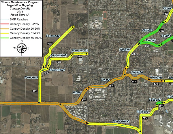
An Example of the Sonoma County Water Agency's LiDAR Derived Canopy Density Maps