
In the 1920s and 30s, forester A.E. Weislander led an effort to map vegetation across the State of California. Though never completed, this effort resulted in set of maps, photos, and vegetation plot data for numerous areas throughout California. This data set provides the best available snapshot of California vegetation during the early part of the 20th century.
The Wieslander Vegetation Type Mapping (VTM) Project, a project conducted jointly between UC Berkeley and UC Davis, has resulted in the digitization of the Wieslander plot data, photos and many of the vegetation map sheets. The VTM project was jointly funded by the US Department of Agriculture and UC Berkeley. Much of the GIS work for the Wieslander VTM project was undertaken by Dr. Maggi Kelley's laboratory at UC Berkeley. Dr. Kelley serves as an Advisory Committee member for our Vegetation Mapping Program here in Sonoma County.
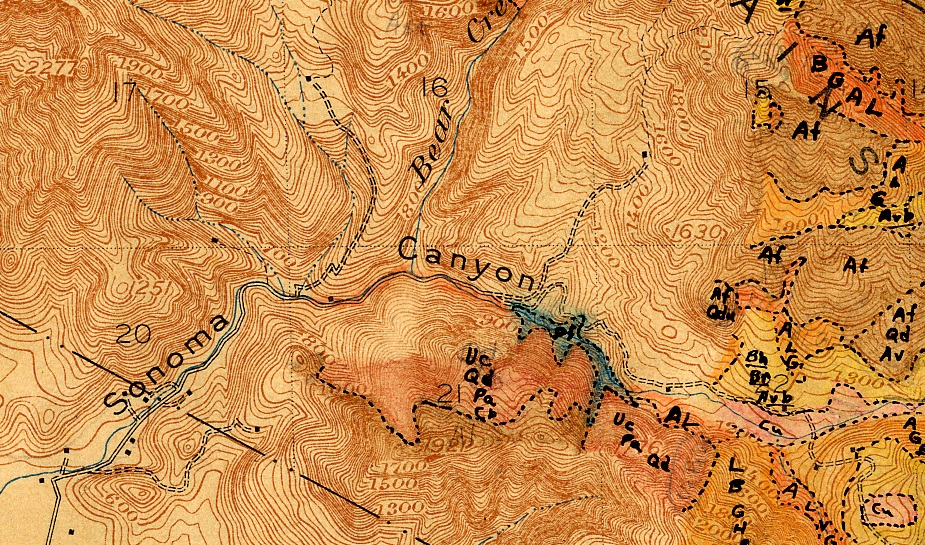
Example of a Wieslander Vegetation Map from Sonoma Valley
The Wieslander maps are of interest to the Sonoma County Vegetation Mapping Program because - once the Sonoma County map is produced - the Wieslander maps can be compared to the new Sonoma County Vegetation map to see how vegetation has changed in the past 70 years or so.
Wieslander plot data is limited to only 13 available plots in southern Sonoma County. But Wieslander vegetation maps exist for a number of areas within the county, including the far northern section of the county, and the southeastern part including the southern Mayacamas Mountains.
In addition to digitizing the vegetation related data and photos, the University of California also has captured digital transcripts of interviews conducted with A.E. Weislander in 1985. These are fascinating to read.
To download the map or the plot data for Sonoma County, go to http://vtm.berkeley.edu/data/ and click "Data by County."